Bonaire is renowned for its world-class diving, yet it also holds treasures beyond the sea. One of the hidden thrills of the island is traversing the Queen’s Highway, or Kaminda Turistiko. This coastal road runs along the island’s northwestern edge, connecting the capital, Kralendijk, to the historic village of Rincon.
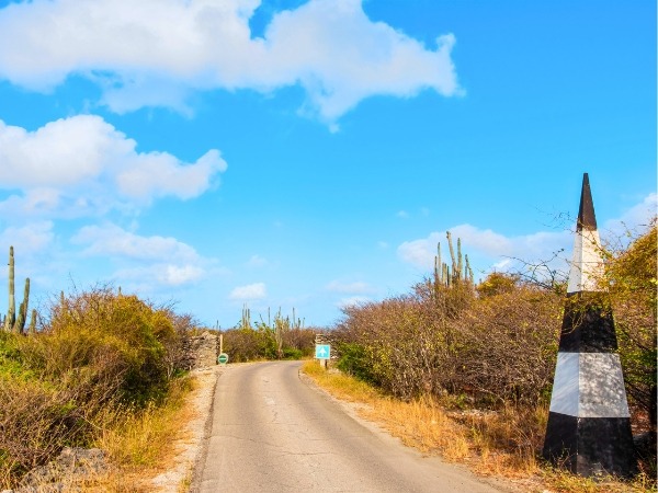
This is not just a route; it’s a sensory journey through Bonaire's stunning landscapes, featuring limestone cliffs, sapphire waves, and a desert interior filled with life. Unlike the flat southern salt pans, the northern landscape is rugged and dramatic. The Queen’s Highway hugs the ironshore, offering a genuine sense of exploration away from crowded tourist spots.
Travelling this road requires an adventurous spirit, rewarding curious travellers with stunning beaches and opportunities to observe nature up close. With its focus on conservation, the road winds through protected areas, making it a must-visit for photographers, history enthusiasts, and anyone seeking a breathtaking drive that captures Bonaire’s essence.
The journey begins at the iconic landmark known as 1000 Steps. Despite the intimidating name, it involves only about 67 limestone stairs. The return trek in the Caribbean heat, with heavy diving gear, can make the name feel more apt. From the top, you are greeted with a panoramic view of the coastline, where the water transitions through stunning shades of blue, from pale turquoise near the shore to deep indigo at the reef drop-off.
At the bottom, a small, pebbled beach of bleached coral awaits, making it a prime location for shore snorkelling due to its vibrant reef. Even if you prefer to stay dry, the cliffs provide a unique vantage point to spot sea turtles surfacing in the shallow bays. The early morning tranquillity here is unmatched, offering a moment of reflection before the true adventure begins.
As you drive northward, the road hugs the limestone terrace, revealing Bonaire's geological history. To your right, steep cliffs display layers of coral reef that emerged from the sea thousands of years ago. One notable feature is the Devil’s Mouth, a cave formation resembling a giant jaw, showcasing the island's powerful natural forces at work.
Nearby lies Tolo, a more secluded coastal spot compared to the crowded 1000 Steps. With its tucked-away beach and clear waters, Tolo provides a private retreat for those looking to dip in or enjoy the tranquillity of the waves. The road here remains two-way for a short stretch, inviting you to linger before reaching the point of no return.
The historical heart of the Queen’s Highway is at Landhuis Karpata, marking the end of two-way traffic as the road becomes a strict one-way route north. Here, the ruins of a nineteenth-century plantation house reflect Bonaire’s agricultural past, when aloe vera was produced, and goats were raised. The yellow lime kiln on the property showcases the island’s industrial heritage, having once provided lime for traditional buildings.
Walking down to the shore at Karpata offers a unique experience. The shoreline consists of large chunks of elkhorn and staghorn coral rubble rather than sandy beaches. The retreating waves pull through these fragments, creating a melodic clinking sound known locally as “the music of the reef”. This hauntingly beautiful place invites you to explore the connection between the island's human history and its rugged natural environment.
Leaving Karpata behind, you enter the most dramatic part of the drive along the Queen’s Highway. The road narrows to a single lane, squeezed between a towering limestone wall and the open ocean. This section is known for its exciting views, with cliffs on one side and crashing surf on the other, creating a sensation of being on the edge of the world. Waves can send sprays that mist your windscreen, adding to the thrill.
Stopping is generally not permitted here, so you must remain focused on the road while your passengers take in the incredible views. The combination of cliffs and vibrant blue water offers a unique, tunnel-like experience, showcasing both engineering and natural beauty. This exhilarating stretch serves as a stunning farewell to the coast before the road heads inland toward the wetlands.
The landscape transforms as the road diverts from the coast, leading to Lake Goto, the largest saltwater lagoon on the island and a designated Ramsar site. This area serves as a key sanctuary for Caribbean Flamingos. Here you can observe the stunning birds in their natural habitat. Surrounded by green hills and cacti, the vibrant pink of the flamingos creates a striking contrast against the landscape.
An elevated lookout point offers a panoramic view of the lagoon, allowing for observation without disturbing the shy flamingos. Watching them sift through the saline water, framed by rugged hills, underscores Bonaire’s dedicated conservation efforts. The air here is infused with the earthy scent of wetlands, accompanied by the sounds of a thriving avian ecosystem.
Further along the route, you arrive at Dos Pos, or Two Wells, a lush oasis in an otherwise arid landscape. The presence of fresh water results in denser vegetation, making it a crucial habitat for Bonaire’s terrestrial wildlife. It’s the best spot on the island to see the rare Yellow-shouldered Amazon Parrot, known locally as the Lora, often seen flying in pairs or small groups, their calls echoing through the valley.
In addition to the Lora, Dos Pos is home to the Caribbean Parakeet and various other bird species. The slow, winding drive encourages you to keep your windows down to enjoy the sounds of the forest. This area acts as a transition zone between the wetlands of Lake Goto and the historical settlement of Rincon, with the old wells serving as a reminder of the vital importance of water in the island’s history, attracting both humans and animals for centuries.
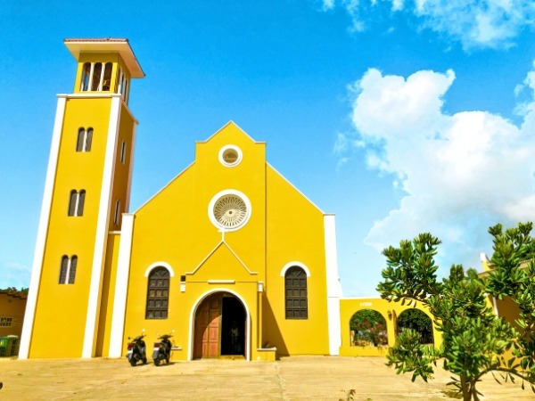
The Queen’s Highway leads you to the village of Rincon, established by the Spanish in the sixteenth century as the oldest settlement in the Dutch Caribbean. Unlike the busy port of Kralendijk, Rincon offers a slower pace of life, nestled in a fertile valley that historically shielded its inhabitants from pirate raids. The village is rich in vibrant traditions, colourful architecture, and warm hospitality.
No visit to Rincon is complete without stopping at the Cadushy Distillery, where the Kadushi cactus is transformed into liqueurs, including a bright green spirit that symbolises the island. After the distillery, enjoy a meal at a local eatery featuring traditional goat stew or iguana soup. Relaxing in a posada and taking in the valley views allows you to fully appreciate the authentic island experience that Rincon embodies.
Driving along the Queen’s Highway in Bonaire reveals that the true treasures of a destination often lie off the main paths. This journey takes you from the majestic coastal cliffs to the serene inland lagoons, culminating in the rich history of Rincon. It highlights Bonaire’s dual nature as a rugged landscape and a vibrant community, deepening your appreciation of the island's unique tapestry.
More than a scenic drive, the Queen’s Highway tells the story of the island's ancient coral formations, colonial plantation history, and modern conservation efforts. The experience is filled with the sounds of wind in the cacti, glimpses of flamingos, and the striking meeting of land and sea.
To truly embrace the north's beauty, you need the freedom a rental car provides. This allows you to stop for breathtaking views or linger at hidden snorkelling spots. Book a car on Final Rentals to explore Bonaire at your own pace and uncover the island’s hidden gems that tour buses can’t reach. Your adventure awaits!